
Import spatial data
Imports spatial data, into new or existing CAD drawings, as CAD objects and Extended Entity Data (EED)
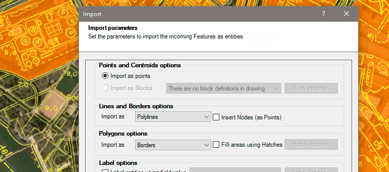
Import spatial data

Export spatial data
Export objects from the drawing to spatial files or databases, and saves their Extended Entity Data (EED) as alphanumeric data tables
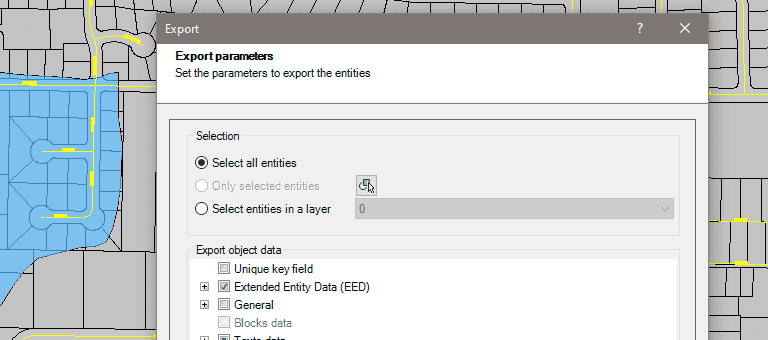
Export spatial data
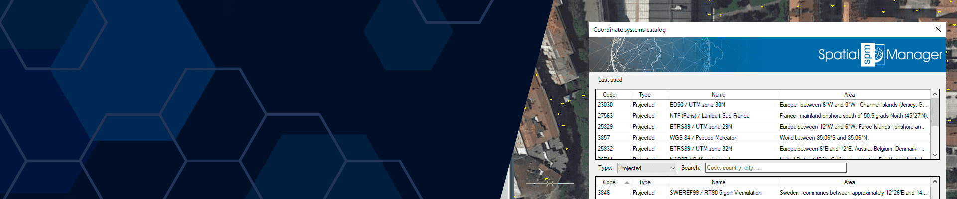
Coordinates transformation
Calculate geometric transformations of the objects in the import and export processes
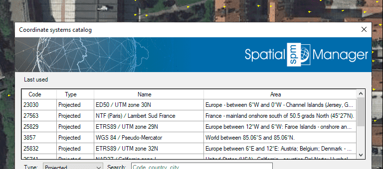
Coordinates transformation

Background Maps
Choose from among a lot of dynamic Backgrounds Maps such as OpenStreetMap, Bing, MapBox, etc., or configure your own maps from TMS, WMS or WMTS servers
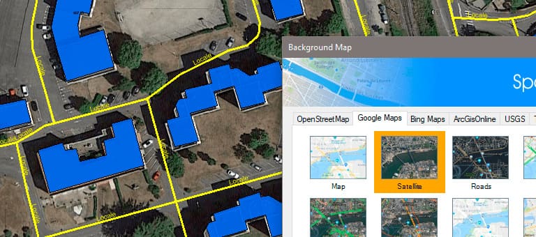
Background Maps

Publishing to Google Earth
Export all or part of the elements (2D and 3D), in the visible Layers of the map and their data to a KML or KMZ file
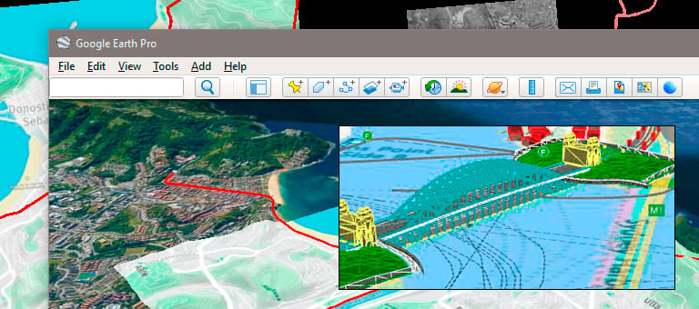
Publishing to Google Earth
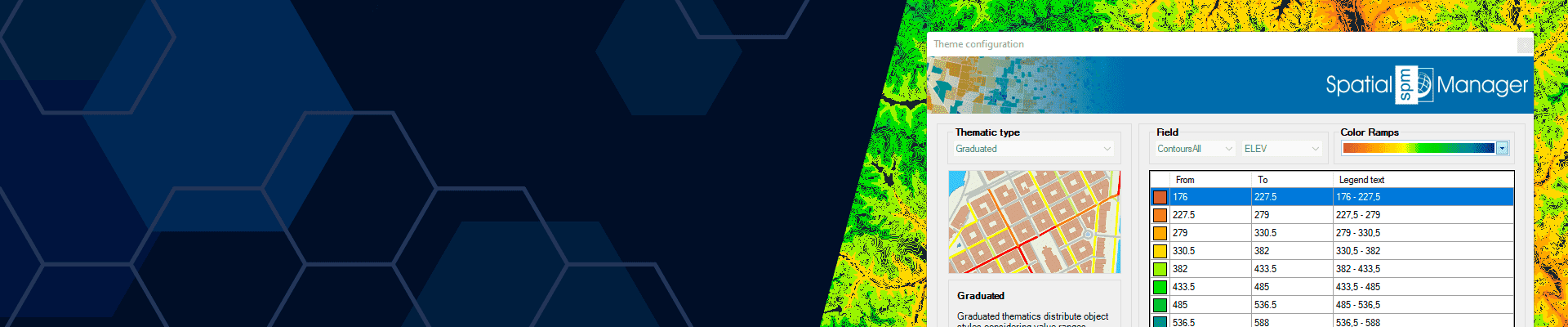
Thematic maps
Visualize objects coloring them depending on their field values
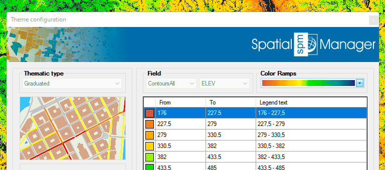
Thematic maps
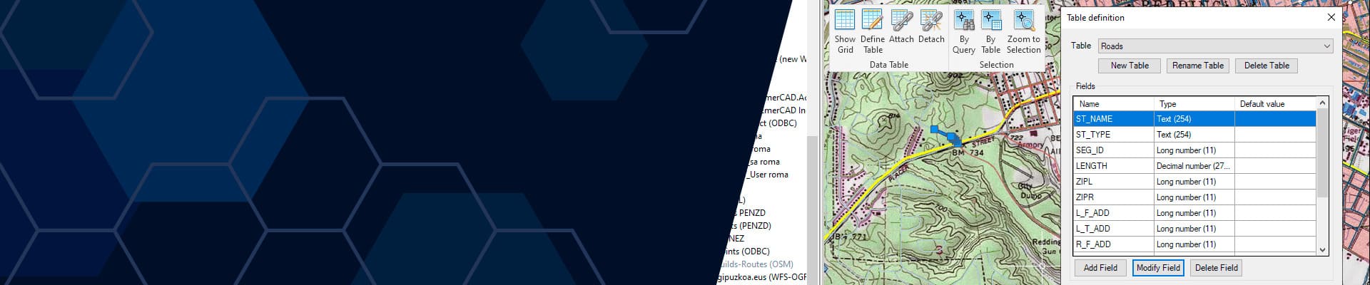
Data management, query and edition
Manage the alphanumeric data attached to the objects, design and edit the structure which will be used to store the data
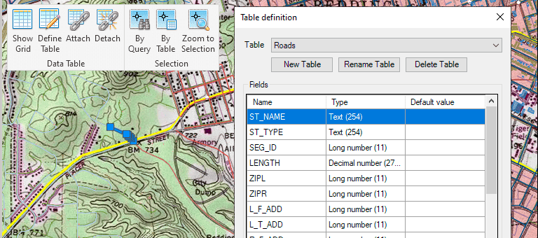
Data management, query and edition
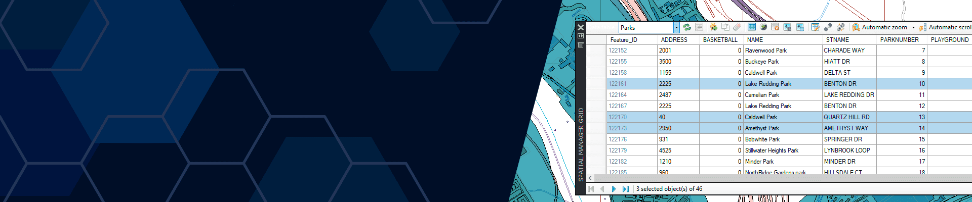
Data grid
The Data Grid palette allows you to view, edit, etc. the objects data in any table in the drawing. You can also select objects from the Data Grid, export the data from the tables and more
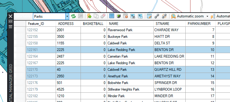
Data grid
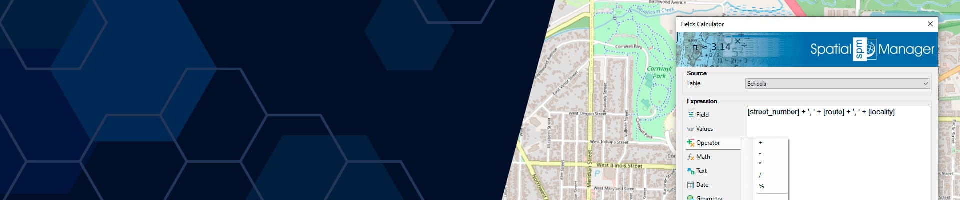
Fields calculator
Calculate simple or complex expressions using operators and functions that can be applied to field values in a table and/or to constant values
Fields calculator

Spatial analysis
Perform spatial analysis operations over the objects in the drawing generating new objects from such analysis
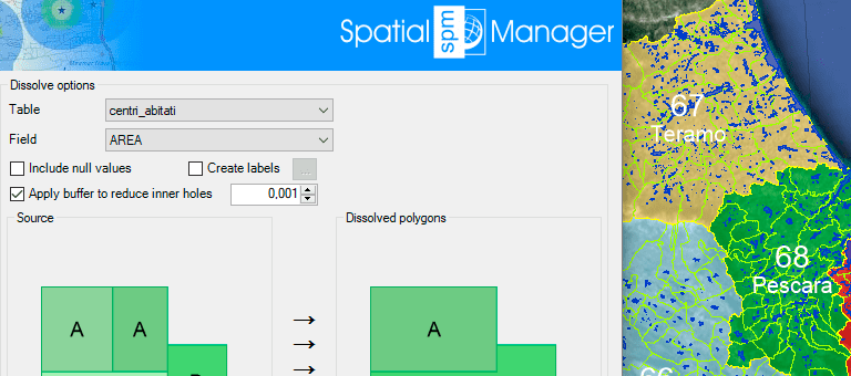
Spatial analysis
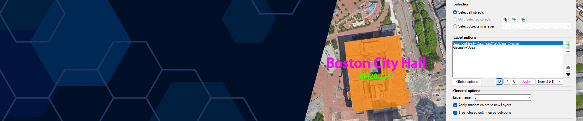
Label objects
Label data values from tables attached to the objects as Texts
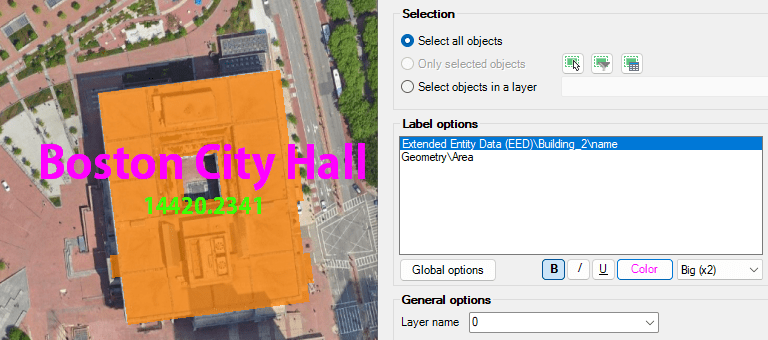
Label objects

Location tools
Location and geo-coding tools help to add reference elements and enhanced data to existing objects
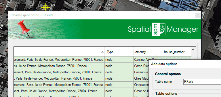
Location tools

Google Street View integration
Google Street View dynamic image browser on any geo-referenced drawing or map

Google Street View integration

Terrains
Create Terrains and other related objects (3D Points, Contours, etc.) from 3D data or from Elevation services
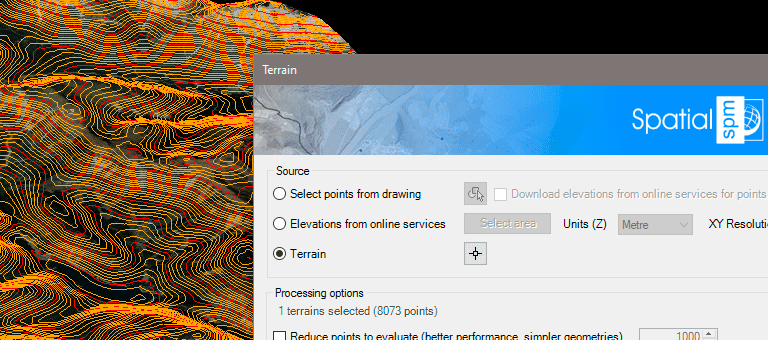
Terrains

Map Books
Create atlas-like layouts automatically within your DWG, organize and print multi-page maps with viewports, titles, and layouts
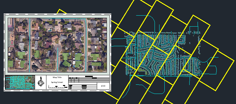
Map Books

Geometry tools
A set of tools to edit and transform polylines, polygons, and other spatial geometries
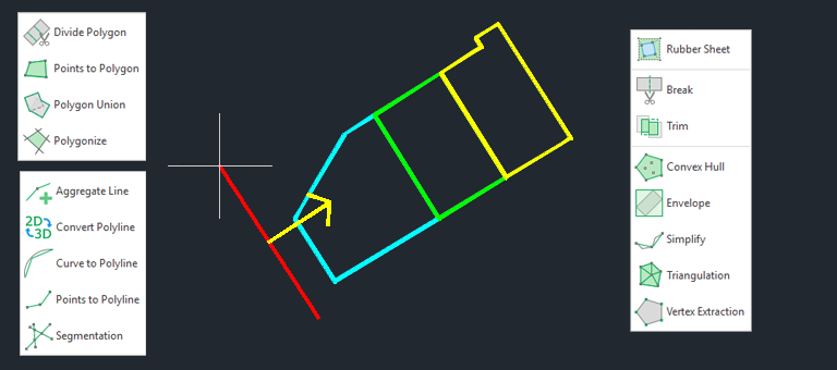
Geometry tools
")
")
")
")
")


