Google Earth internally works with meters as elevation units and this can be an obstacle when feet are the desired measurement units. This tutorial explains an easy workaround for viewing contour elevations values in Google Earth and their elevations in feet
Available for AutoCAD, BricsCAD, ZWCAD and GstarCAD
1. Create Labels with elevation in feet
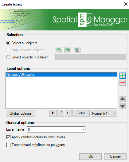
- Execute SPMLABEL command
- Click on the “plus” button and select “Geometry/Elevation”
- Also uncheck “Treat closed polylines as polygons” if your geometries are line types
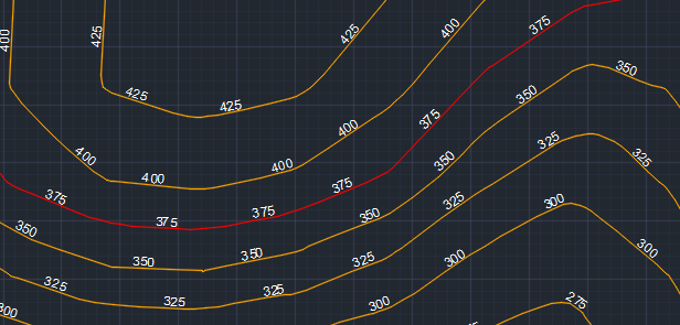
- Click OK, and the labels will be created along the polylines
2. Export to Google Earth
- Execute SPMCREATEKML command and create a KML with both contours and elevations in feet as texts
- Select “3D objects” as type
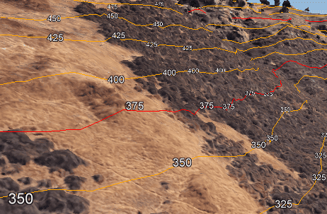
- The texts are exported to Google Earth helping to identify the elevations in feet
- Be careful if you use the terrain layer in Google Earth, the texts and the polylines could mess with the terrain, this is a normal behavior
- The same process can be done for labeling elevation if the units are meters and you want to identify visually the elevation values as texts in Google Earth
Note: Some functionalities can be found in the Standard or Professional editions only


