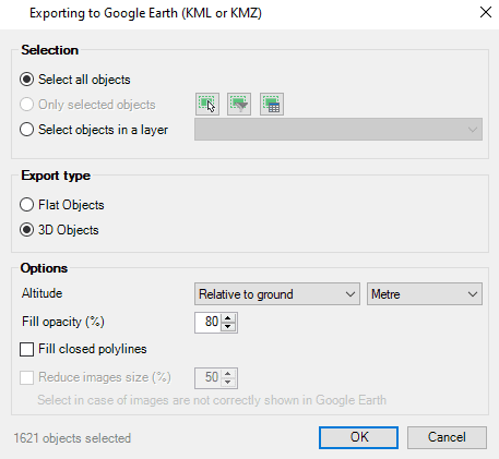
3D modeled objects are exported to Google Earth (KML/KMZ) in a very easy and intuitive way. Different altitude and height modes are available depending on how the model has been created and the way want to be represented (relative to ground, sea floor, absolute…)
Available for AutoCAD, BricsCAD, ZWCAD and GstarCAD
SPMCREATEKML command performs a simple one-step publish method. Select if you need to export flat or 3D objects, some optional parameters, and create directly a KML or KMZ file. Coordinate transformation will be applied automatically when needed
Export type
- Flat objects: recommended for elements like parcels or roads, that will be represented attached to the floor
- 3D objects: suggested for geometries elevated over the floor or 3D modeled (buildings, infrastucture, elevation contours, …)
Multiple type of 3D objects are now supported: faces, solids, polyfaces, meshes, surfaces, regions, … and other complex or compound objects can be exploded and then exported
Note: Some functionalities can be found in the Standard or Professional editions only


