What is the easiest way to integrate Google Maps into AutoCAD?
In the video below you can see how to view Google Maps in the background of your AutoCAD drawings (DWG/DXF)
Step-by-Step guide for using Google Maps in AutoCAD with Spatial Manager
If you haven’t installed Spatial Manager for AutoCAD yet, you can begin a free trial here. If you’re already a user, be sure to update to the latest version.
1. Prepare Your Drawing with Georeferencing
Before bringing in Google Maps, it is essential to georeference your AutoCAD drawing. Spatial Manager simplifies this by allowing you to assign a coordinate system to your drawing, ensuring that all imported map data aligns with real-world locations.
- Execute SPMSETCRS command, you can locate it on the menu, ribbon or toolbar under “Spatial Manager/Main/Coordinate System”.
- Look for your preferred Coordinate Reference System, find it by EPSG code, name, country or area name, …
- If you have already a georeferenced drawing, or need to start a new drafting project, go straight to the next step.
2. Add Google Maps as Background Map
Spatial Manager offers a straightforward process to add Google Maps as background layers in AutoCAD. Follow these steps:
- Execute SPMBGMAPSHOW command within AutoCAD, use Spatial Manager’s interface to access the Background Maps feature, seek it on “Background Map/Show” on ribbon and menus.
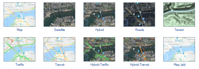
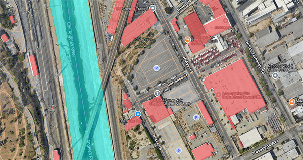
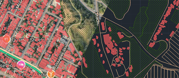
- In Google Maps group you can select various types of maps, including street maps, satellite imagery, terrain, roads, and hybrid views, depending on your project’s requirements.
3. Zoom and Adjust Viewports
Once Google Maps imagery is integrated into your AutoCAD project, you can adjust the zoom level and viewport size to fit your needs, the background map will be automatically updated on view changes, even as a transparent function while other commands are executing. Spatial Manager allows you to modify the extents of the imported map without losing any resolution, ensuring high-quality imagery. Additionally, you can update or refresh the imagery as your project evolves.
4. Toggle Visibility
Spatial Manager provides a convenient feature to toggle the visibility of background maps, including Google Maps. This allows you to easily switch between viewing your CAD drawing and the underlying map without cluttering your workspace. By doing so, you can check your design against real-world conditions as needed, ensuring accuracy throughout the project lifecycle.
- Execute SPMBGMAPHIDE command for hiding the background map.
Optional Steps
Import a Google Maps image as a raster to DWG or DXF
- Just execute SPMBGMAPIMAGE command and make a capture of the desired area or the current view. A raster image will be created and inserted as a reference. Then you could work offline, or share your project with others.
- You can either manually define the area you wish to import or use the current viewport to fetch the map imagery for the specific region you are working on. The imagery is automatically scaled and georeferenced to match your drawing.
Google Street View in AutoCAD
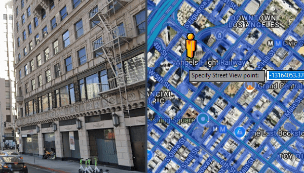
- Review Google Street View directly within AutoCAD on an integrated palette.
- Execute SPMSTREETVIEW command, specify a point on the drawing and view street level images.
- Review more details about this awesome feature.
Are there other background maps available?
Spatial Manager not only supports Google Maps but also allows users to select other background map sources such as OpenStreetMap, Bing Maps, or custom tile or WMS servers. This flexibility ensures that you can always use the most relevant and up-to-date aerial maps for your projects.
It is possible to integrate with other Google Services?
There is a full range of tools for integrating with other Google products:
- Publishing to Google Earth: SPMCREATEKML command allows exporting to KML/KMZ format in a one-step, maintaining most of the drawing styles and compatible with almost all geometry types, including 3D ones. Learn more.
- Import from KML/KMZ: SPMIMPORT command is useful for importing from KML/KMZ files, automatic coordinate transformation will be applied if needed, review the complete range of options.
- Search locations and direct and reverse geo-coding is available on location tools. Note: for using some services an API key is required.
What happens if the Coordinate Reference System does not match with Google Maps?
Automatic transformation is selected and applied based on the project area. If it still does not fit perfectly, it is possible to adjust your geometries to the base map using some drawing tools like rubber sheet.
Why Use Google Maps in AutoCAD with Spatial Manager?
Integrating Google Maps into AutoCAD via Spatial Manager has several advantages:
- Enhanced Project Accuracy: Real-world context for your design helps minimize errors.
- Time-Saving Features: Georeferencing and map imports are automated, reducing manual effort.
- Visual Clarity: Toggle between technical designs and map views to better understand the site layout and surrounding area.
- Spatial Manager makes it easy to bring Google Maps and other geospatial data directly into AutoCAD, improving project efficiency and quality. Learn more about the process and features here.
What versions and editions of AutoCAD are compatible?
All versions from AutoCAD 2013 are compatible and also other vertical Autodesk products like Autodesk Civil 3D or AutoCAD Map 3D. As soon as Autodesk releases a new version, an updated version of Spatial Manager for AutoCAD will be ready to ensure the compatibility from day-one.


