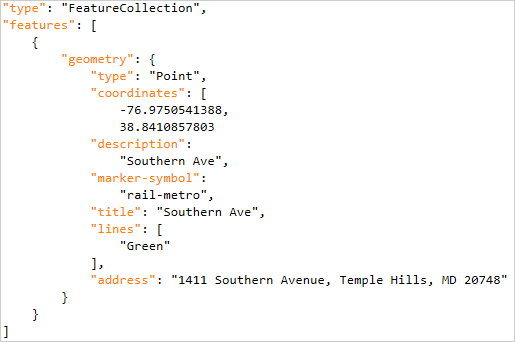
GeoJSON is an open standard geospatial data format based on JSON (JavaScript Object Notation). The content is stored as plain text, structured for allowing complex or compound geometries and with attached data. Most common file extensions are .geojson, .geo.json and even a generic .json
Available for AutoCAD, BricsCAD, ZWCAD, GstarCAD and Desktop
Spatial Manager products includes an own data provider for GeoJSON files. It allows import to DWG and export and convert between multiple geospatial formats (Shapefile, KML, GML, SQLite, …)
Import
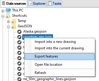
- Spatial Manager for CAD (AutoCAD/BricsCAD/ZWCAD/GstarCAD) can import GeoJSON to DWG using SPMIMPORT command or directly from the Data Sources palette
- Spatial Manager Desktop opens GeoJSON and allow to visualize and integrate with other data sources
Export
- Spatial Manager for CAD (AutoCAD/BricsCAD/ZWCAD/GstarCAD) can export from DWG to GeoJSON using SPMEXPORT command or directly to Google Earth with SPMCREATEKML command
- Spatial Manager Desktop opens GeoJSON and allow to visualize and integrate with other data sources
Convert
- From Spatial Manager data sources panel GeoJSON can be converted directly to other formats and also transforming the Coordinate Reference System
Encoding
Like all text files, GeoJSON allows to use diferent encodings for representing different character sets for diverse languajes (UTF-8, ISO-8859-1, Windows-1252, …) For allowing the interoperability between different systems, while importing and exporting the character encoding can be selected
Coordinate Reference System
GeoJSON latest specification uses WGS84 as coordinate reference system and decimal degrees as units for latitude and longitude. Although some legacy files using other coordinate reference systems, even projected, can still be found. Any of them is recognized by Spatial Manager
Note: Some functionalities can be found in the Standard or Professional editions only


