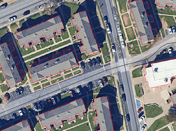
Import of georeferenced raster images into the drawing. Supports a variety of formats such as TIF, PNG, JPG, JPEG, TIFF, Cloud Optimized GeoTIFF, ... (Data Providers list). It also allows the transformation of coordinates during the process
Export images New V9
Export of georeferenced raster images from the drawing. Supports a wide variety of georeferenced formats such as TIF, PNG, JPG, ...(Data Providers list). It also allows the transformation of coordinates during the process
Import of photos with EXIF GPS data New V9
Import of photographs with GPS location (contained in their EXIF data), captured at the moment they are taken and automatically placed in their correct location in the drawing when importing
Export World File New V9
Export to external file the complete geo-reference information of any raster image contained in your drawing
Import images from Google Earth
Import high quality and historic raster images from Google Earth using a configuration file (.geprint) that stores the map options and its geolocation


