The Farm Service Agency of the U.S. Department of Agriculture (USDA) provides some web services for accessing the National Agriculture Imagery Program (NAIP). Spatial Manager products provide an easy way to integrate its ortoimagery on your own projects and drawings (DWG/DXF)
Available for AutoCAD, BricsCAD, ZWCAD, GstarCAD and Desktop
1. Configure USDA Background Map
- Execute SPMBGMAPSHOW command
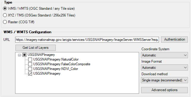
- Configure custom map, click the Configure Backgound Maps button
- Set URL:
https://imagery.nationalmap.gov/arcgis/services/USGSNAIPImagery/ImageServer/WMSServer?request=GetCapabilities&service=WMS
- Click Get List of Layers
- Select the visualization, for example USGSNAIPImagery for photographic natural color
- Set your desired Name (USGSNAIPImagery) and Group (USDA)
- Save
2. Configure alternative visualizations
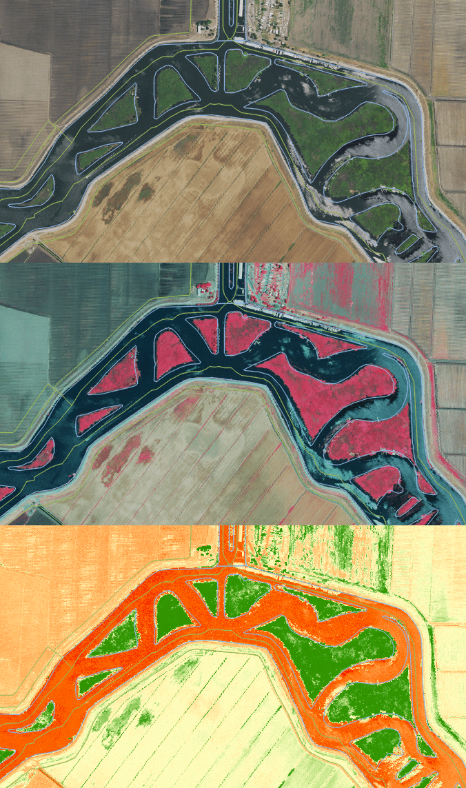
- If you also want to create maps for alternative visualizations like color-infrared (false color) or vegetation (NDVI), repeat steps from section 1 selecting other layer, change Name and click Save as a copy
3. Activate Background Map and alternate between styles
- You can activate a Background Map with the SPMBGMAPSHOW command
- And easily alternate between styles from SPM palette
USGS NAIP Imagery
The USGS NAIP Imagery service from The National Map (TNM) consists of high resolution aerial images that combine the visual attributes of an aerial photograph with the spatial accuracy and reliability of a map. Presented in natural color, this service also supports the use of templates that can be used to dynamically generate ‘false color’, also known as color-infrared (CIR), and Normalized Difference Vegetation Index (NDVI) views of the data.
Service Url:
https://imagery.nationalmap.gov/arcgis/services/USGSNAIPImagery/ImageServer/WMSServer?request=GetCapabilities&service=WMS
USGS NAIP Plus
The USGS NAIP Plus service from The National Map consists of National Agriculture Imagery Program (NAIP) and high resolution orthoimagery (HRO) that combine the visual attributes of an aerial photograph with the spatial accuracy and reliability of a map. Many states contribute orthoimagery to the National Map, and the USGS also relies on a partnership with the U.S. Department of Agriculture’s Farm Service Agency.
Service Url:
https://imagery.nationalmap.gov/arcgis/services/USGSNAIPPlus/ImageServer/WMSServer?request=GetCapabilities&service=WMS
Note: Some functionalities can be found in the Standard or Professional editions only


